Intertropical Convergence Zone (ITCZ): How Pilots Navigate Giant Oceanic Storms
Introduction: The Equatorial Wall in the Sky
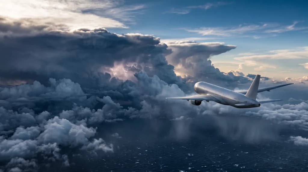
For most passengers aboard intercontinental flights from Europe to South America, Sub-Saharan Africa, or Southeast Asia, a nocturnal crossing of the equator is remembered merely as the moment the seatbelt signs chime on and the aircraft begins to sway gently in the darkness. Few realize that just outside the cabin windows, a few hundred yards beyond the wingtips, one of the most powerful and violent atmospheric phenomena on Earth is unfolding. This is the Intertropical Convergence Zone (ITCZ), known to early mariners as the Doldrums, and referred to by modern airline pilots simply as "the weather wall."
The ITCZ is a continuous belt of deep convection encircling the globe where moisture-laden trade winds from the Northern and Southern Hemispheres collide. These are not isolated thunderstorm cells that can be easily sidestepped with a minor heading adjustment. Rather, they are colossal, multicellular Mesoscale Convective Systems (MCS), where the tops of Cumulonimbus clouds punch straight through the tropopause to altitudes of 55,000 to 60,000 feet (16–18 kilometers)—well above the maximum service ceiling of any modern commercial airliner. Navigating across the ITCZ over the middle of the Atlantic, Indian, or Pacific Oceans, far beyond the reach of ground-based radar stations and diversion airports, stands as one of the ultimate tests of weather navigation, fuel management, and high-altitude aerodynamics.
Physics of the Equatorial Cauldron: Why Superstorms Form in the ITCZ
To understand why the Intertropical Convergence Zone poses such a formidable operational challenge, one must look at the global atmospheric circulation pattern known as the Hadley Cell. Near the equator, solar radiation strikes the ocean surface almost perpendicularly, heating the water to temperatures of 82°F to 86°F (28–30°C). Intense evaporation saturates the lower boundary layer of the atmosphere with vast quantities of water vapor and latent heat energy.
Simultaneously, steady trade winds converge toward the equator from both north and south. When these air masses meet in the equatorial trough, the air has nowhere to escape horizontally—its only path is rapid vertical ascent. As warm, humid air rises, it cools adiabatically; water vapor condenses and releases immense amounts of latent heat, further accelerating the updrafts. The result is towering convective chimneys with vertical velocities reaching 6,000 to 10,000 feet per minute (30–50 meters per second), capable of lofting hundreds of thousands of tons of supercooled water droplets and hail to 50,000 feet within minutes.
Crucially for flight planning, the ITCZ is not a static line drawn neatly along the geographical equator. Instead, it migrates seasonally following the thermal equator: in July, it shifts well into the Northern Hemisphere (reaching as far as 15°N–20°N over West Africa and Asia), whereas in January, it dips into the Southern Hemisphere. For flight crews operating routes from Frankfurt, Paris, or Warsaw to São Paulo, Buenos Aires, Johannesburg, or Bangkok, penetrating this barrier is an unavoidable reality on every single rotation.
Eyes of the Flight Deck Over Open Ocean: How Airborne Weather Radar Works
Over the open ocean, hundreds of nautical miles from the coasts of Brazil, Senegal, or India, ground-based meteorological radar coverage does not exist. Flight crews cruising at flight levels FL350 to FL390 (35,000–39,000 feet) on a pitch-black, moonless night rely almost exclusively on their airborne weather radar (WXR) housed inside the aircraft's dielectric nose cone (radome).
What Radar Cannot See: The Ice Crystal Trap
A common misconception is that weather radar detects clouds. In reality, the microwave beam transmitted by the radar antenna reflects solely off liquid water (raindrops) and wet hail. The dry ice crystals that form the upper anvil sections of Cumulonimbus clouds at cruising altitudes are virtually invisible to radar energy. If a captain leaves the radar beam aimed strictly horizontally at FL370, the Navigation Display (ND) may show a reassuringly black screen even as the aircraft flies directly toward severe turbulence and high-altitude icing.
Consequently, a critical operational technique when approaching the ITCZ is manual management of Antenna Tilt and receiver Gain. Pilots tilt the radar beam downward by several degrees to peer deep into the storm's core around the freezing level (typically between 14,000 and 16,000 feet near the equator), where liquid precipitation generates strong radar returns. Modern multi-scan radar systems (such as the Honeywell IntuVue RDR-4000) perform three-dimensional volumetric scans of the entire airspace ahead, automatically compiling a full vertical threat profile from ground level to cruise altitude.
Color Interpretation and Radar Attenuation
On the cockpit display, precipitation intensity is color-coded: green (light rain), yellow (moderate), red (intense convective core), and magenta (extreme turbulence and hail). The greatest hidden hazard within the ITCZ, however, is radar attenuation. When an exceptionally dense wall of torrential rain stands directly in the beam's path, it absorbs virtually all the microwave energy. The radar paints a solid red band followed immediately by a black void, creating the false impression of clear skies behind the storm. In reality, an even more violent convective cell may be lurking behind that curtain—a hazard flagged by Path Attenuation Compensation (PAC) alerts, which draw a yellow arc at the edge of the display to warn pilots of radar shadowing.
Golden Rules of Storm Avoidance: Safety Margins and Aerodynamics
When a magenta chain of ITCZ cells emerges on the radar screen 160 to 240 nautical miles ahead, the flight crew initiates a calculated chess match with nature. Flying into the core of an equatorial Cumulonimbus risks loss of aircraft control, severe structural damage from golf-ball-sized hail, and even dual-engine flameout caused by ingesting massive concentrations of water and ice crystals (High-Altitude Ice Crystal Icing).
- The 20-Nautical-Mile Rule: Standard Operating Procedures (SOPs) mandate circumnavigating red and magenta convective cores above FL250 by a lateral margin of at least 20 nautical miles (roughly 37 kilometers). Violent updrafts, downdrafts, and wind shear extend well beyond the visible cloud boundary.
- Always Pass on the Upwind Side: When threading a gap between two storm cells, crews consistently choose the upwind side. On the downwind side, upper-level winds blow dense plumes of ice crystals out from the cloud top while generating severe rotor turbulence and intense lightning activity.
- Never Climb Over, Never Dive Under: Attempting to outclimb an ITCZ storm is futile—convective towers can build vertically at 3,000 to 5,000 feet per minute, while an airliner at high altitude operates within the narrow aerodynamic envelope known as the Coffin Corner, where low-speed stall margin and high-speed Mach buffet converge. A sudden vertical gust in this regime can instantaneously exceed both limits. Conversely, descending beneath the cloud base over the ocean exposes the aircraft to violent microbursts and low-level wind shear.
Oceanic Procedures: Deviating Off Course Without VHF Radio
Deviating around thunderstorms over continental Europe or North America is straightforward: pilots request a heading change from Air Traffic Control (ATC) over VHF radio and receive near-instantaneous clearance. Over the mid-Atlantic (such as Dakar Oceanic or Atlantico airspace) or the Indian Ocean, line-of-sight VHF radio coverage ends roughly 200 miles offshore. Communication relies instead on satellite text messaging via CPDLC (Controller-Pilot Data Link Communications) and high-frequency (HF) radio, where controller response times can stretch to ten or fifteen minutes.
When an ITCZ squall line looms directly ahead, pilots cannot afford to wait fifteen minutes for a clearance. Instead, crews execute the international ICAO Oceanic Weather Deviation Procedure:
- The crew broadcasts a warning advisory on the international emergency frequency 121.5 MHz as well as the Interpilot Air-to-Air frequency 123.45 MHz (IFBP), announcing their callsign, position, flight level, and direction of deviation;
- If the lateral deviation from the assigned airway centerline remains within 5 nautical miles (formerly 10 NM in certain oceanic regions), the aircraft maintains its cleared flight level;
- If circumnavigating the storm requires deviating more than 5 nautical miles off track, the pilot is required to immediately execute a 300-foot (90-meter) altitude change—climbing or descending according to a standardized directional table (for instance, descending 300 feet when deviating right while southbound). This ensures vertical separation from opposing or overtaking traffic sharing the same oceanic track in the event ATC contact is delayed.
Fuel Economics and Risk Management: Flight Planning Through the ITCZ
The battle against equatorial weather begins hours before engine start inside the airline's Flight Dispatch center. Flight dispatchers analyze infrared satellite imagery—which measures cloud-top temperatures, where colder tops indicate higher, more dangerous convective towers—alongside global lightning detection networks.
When forecasts show an unusually broad and active ITCZ—particularly around the spring and autumn equinoxes—dispatchers modify the flight plan prior to departure, shifting the oceanic crossing corridor hundreds of miles east or west to pierce the front at its narrowest point. Additionally, the captain loads extra weather contingency fuel. Detouring 150 to 200 nautical miles in a zigzag pattern around oceanic storm cells burns an additional two to three metric tons of jet fuel; running short of reserve fuel over the mid-Atlantic would force an unscheduled technical diversion to Cape Verde or Recife on the coast of Brazil.
Conclusion: The Invisible Art of Navigating Nature's Fury
Crossing the Intertropical Convergence Zone encapsulates the essence of modern long-haul aviation. It is the exact point where satellite meteorology, airborne microwave radar physics, and seasoned crew judgment converge into a seamless safety net. While passengers relax in a warm, dimly lit cabin watching movies or sleeping beneath blankets, the flight deck is engaged in focused, quiet analysis of green-and-magenta radar returns and distant lightning flashes illuminating towering cloud walls miles ahead.
Although equatorial weather unleashes energy rivaling thousands of nuclear detonations, commercial aviation has perfected the procedures required to navigate safely around its edges. The next time you peer out your cabin window on an overnight flight to the Southern Hemisphere and witness silent bolts of lightning illuminating colossal cloud towers from within like celestial lanterns, rest assured: your flight crew spotted that storm an hour ago and has already plotted a smooth, safe path right around it.