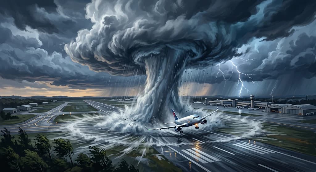
Windshear and Microbursts: The Weather Threat That Taught Aviation Humility
Introduction
In the annals of aviation safety, few atmospheric phenomena have exerted such a transformative influence on aircraft design, crew training syllabi, and airport radar infrastructure as windshear—and specifically its most lethal, concentrated manifestation: the microburst. As recently as the 1970s and early 1980s, heavy passenger airliners were crashing on short final approach or immediately following takeoff in meteorological conditions that crews and accident investigators initially characterized as inexplicable "air pockets" or sudden, uncommanded engine power loss.
Multi-ton commercial airliners were driven into the ground in fractions of a second, often mere hundreds of meters short of the runway threshold, despite control columns held against their mechanical stops and turbofan engines spooling at maximum go-around thrust. Unraveling the physics behind this phenomenon was not the work of armchair theorists, but a relentless battle waged by pioneering atmospheric scientists against the unyielding laws of aerodynamics. Before the microburst was systematically measured, mapped, and countered by terminal Doppler weather radars and predictive flight deck avionics, it claimed hundreds of lives and forced the global aviation industry to fundamentally overhaul its core doctrines regarding operations in the vicinity of convective activity.
The Anatomy of a Microburst: The Physics of an Atmospheric Plunge
What makes a microburst uniquely hazardous to an aircraft in low-altitude flight? Contrary to popular passenger perception, the danger does not stem from a simple, steady headwind or crosswind. The fatal mechanism is an abrupt, violent shift in the horizontal and vertical wind vector—encompassing rapid changes in both direction and velocity—over a very short spatial distance.
A microburst originates within the core of a mature thunderstorm cell (Cumulonimbus – Cb), though it can also descend from seemingly benign convective towers (Cumulus congestus). Its formation is driven primarily by two thermodynamic processes:
- Evaporative Cooling: As precipitation (rain or hail) falls through an unsaturated, dry sub-cloud layer, hydrometeors rapidly evaporate. Evaporation is an endothermic phase transition that extracts significant latent heat from the surrounding air mass. The air parcel within the shaft cools sharply and rapidly.
- Negative Thermal Buoyancy: As it cools, the air parcel becomes substantially denser and heavier than the ambient warm environment. Stripped of hydrostatic equilibrium, this chilled, dense air mass plunges toward the surface under the force of gravity, further accelerated by the downward drag of millions of tons of descending raindrops (precipitation loading).
The result is a localized, concentrated column of descending air—a severe downdraft typically spanning an operational diameter of less than 4 kilometers. When this column, traveling downward at speeds exceeding 30 to 40 m/s (6,000 to 8,000 feet per minute), strikes the terrain, it cannot penetrate the ground. In accordance with fluid continuity, the mass deflects radially outward along the surface in all directions, analogous to a pressurized stream of tap water striking the bottom of a flat sink. This outward dispersion creates a rolling horizontal vortex ring that surges outward along the ground at hurricane-force speeds.
The Aerodynamic Trap: Flight Profiles Through a Microburst
For a flight crew established on a stabilized instrument glide slope, encountering an undetected microburst during approach represents a multi-stage aerodynamic trap that attacks the aircraft's primary energy state: its Indicated Airspeed (IAS).
Traversing the core of the phenomenon triggers three distinct, successive aerodynamic stages:
1. Stage One: The Deceptive Headwind Surge
The aircraft breaches the outer boundary of the horizontal vortex ring, flying directly into an abrupt, gusting headwind. The instantaneous airflow velocity over the lifting surfaces (IAS) rises rapidly, even though the aircraft's inertial speed over the ground (Ground Speed) remains momentarily unchanged due to airframe momentum. This increase in dynamic pressure generates an immediate surge in aerodynamic lift. The aircraft balloons above the glide slope and pitches up. The standard instinctive response from a pilot (or an autopilot operating in approach mode) is to counter this deviation: reducing engine thrust via the throttles and pitching the nose down to capture the assigned descent profile.
2. Stage Two: The Vertical Downdraft Core
Seconds later, the aircraft crosses into the central core of the microburst. The headwind component collapses, and the airframe is struck by a powerful vertical downdraft pushing downward at thousands of feet per minute. The aircraft's vertical descent rate spikes alarmingly, compounded by the fact that the engines are still spooling at the reduced power settings commanded during the initial headwind encounter.
3. Stage Three: The Tailwind Shear and Lift Collapse
Exiting the downdraft core, the aircraft immediately penetrates the opposing side of the radial vortex ring, where the ambient wind shifts instantly to a strong, gusting tailwind. In an instant, indicated airspeed plummets—frequently dropping 30, 40, or even 50 knots below the aircraft's approach target, well into aerodynamic stall territory. The wings lose the airflow required to sustain flight. Starved of airspeed and kinetic energy, the aircraft enters a high-rate sink toward the terrain. Even if the crew immediately commands maximum takeoff/go-around thrust (TOGA), large high-bypass turbofans require between 4 and 8 seconds to spool up from idle to full power. At an altitude of 300 to 500 feet above the ground, that delay is fatal.
Ted Fujita: The Lone Visionary Challenging Academic Orthodoxy
Modern low-altitude flight safety owes a profound debt to a single researcher: Dr. Tetsuya "Ted" Fujita of the University of Chicago (renowned creator of the Fujita Tornado Damage Scale). Following the fatal crash of Eastern Air Lines Flight 66 at New York's JFK Airport in 1975, where a Boeing 727 crashed on approach during a thunderstorm, Fujita conducted meticulous aerial surveys of tree-fall patterns and debris distribution at the site.
Fujita formulated a radical hypothesis: convective cloud systems could generate localized, vertical downdrafts that strike the surface and explode outward in starburst patterns. He coined the term downburst, designating smaller, high-intensity events under 4 kilometers in scale as microbursts.
The atmospheric science and aeronautical engineering communities initially met Fujita's findings with sharp skepticism. Prevailing meteorological consensus maintained that convective downdrafts could not exceed modest vertical velocities, attributing low-altitude weather crashes to pilot error or poor airspeed management. Undeterred, Fujita launched project NIMROD (Northern Illinois Meteorological Research on Downburst) in 1978, followed by the landmark JAWS (Joint Airport Weather Studies) project in 1982, deploying experimental Doppler radar networks. The empirical findings were indisputable: Fujita captured dozens of microbursts in real time, validating their existence, documenting their extreme shear profiles, and proving their acute danger to civil aviation.
Historical Turning Points: Crashes That Mandated Structural Change
Three high-profile commercial airline accidents in the United States served as the tragic catalysts that forced regulatory mandates for windshear detection technology.
1. Eastern Air Lines Flight 66 (1975, New York-JFK)
Operating a Boeing 727 on approach to Runway 22L at JFK through a localized thunderstorm cell, the flight penetrated a severe microburst, suffered a catastrophic loss of airspeed, and impacted the approach light piers short of the threshold, resulting in 113 fatalities. This accident prompted Ted Fujita to formalize his microburst research.
2. Pan Am Flight 759 (1982, New Orleans)
Shortly after lifting off from Runway 10 at New Orleans International Airport, another Boeing 727 entered an intense microburst generated by a localized convective cell. At an altitude of barely 100 feet, despite full takeoff thrust, the aircraft was forced down by descending air and severe tailwind shear, clipping trees and crashing into a residential neighborhood in Kenner, Louisiana. The accident claimed 153 lives (including 8 on the ground) and eliminated lingering scientific doubts regarding the lethal nature of low-altitude downbursts.
3. Delta Air Lines Flight 191 (1985, Dallas/Fort Worth)
The definitive watershed event in the history of windshear safety. A wide-body Lockheed L-1011 TriStar was tracking the ILS to Runway 17L at DFW through heavy localized rain. At approximately 700 feet, the aircraft encountered a massive wet microburst. The sudden transition from an intense headwind to a severe downdraft and subsequent tailwind pushed the wide-body into the ground north of the airfield. The TriStar crossed a major highway, colliding with a passing vehicle, before impacting water storage tanks on the airport perimeter and erupting in flames, killing 137 people.
The National Transportation Safety Board (NTSB) report on Delta 191 produced sweeping recommendations. It legally mandated the accelerated deployment of dedicated ground-based Doppler radar networks and required all commercial passenger airliners to be equipped with certified airborne windshear detection systems.
The Technological Countermeasure: Modern Detection and Warning Systems
The aviation industry's technical response produced an integrated, multi-layered early warning and detection infrastructure that transformed the microburst from an unseen ambush into an observable, avoidable risk.
1. Ground-Based Sensor Networks: TDWR and LLWAS
Airports worldwide, particularly those located in storm-prone geographic regions, rely on paired ground detection systems:
- Terminal Doppler Weather Radar (TDWR): High-resolution, dedicated Doppler weather radars positioned 10 to 20 kilometers from primary airport complexes. By measuring frequency phase shifts in microwave radiation bounced off hydrometeors and airborne particulate matter, TDWR detects localized radial velocity shears in the boundary layer minutes before an arriving or departing aircraft crosses that airspace.
- Low Level Windshear Alert System (LLWAS): A network of remote ultrasonic anemometers and barometric sensors mounted on elevated masts along runways and approach corridors. Real-time algorithms cross-compare wind vectors across the airfield. When vector differentials cross critical thresholds, tower controllers receive instantaneous warnings (e.g., "Windshear alert, 30-knot loss on 2-mile final") to relay directly to crews.
2. Flight Deck Defensive Avionics: Reactive and Predictive Windshear
Modern transport-category aircraft feature redundant onboard detection systems integrated directly into primary flight displays and flight management computers:
- Reactive Windshear Systems (RWS): Built into the Enhanced Ground Proximity Warning System (EGPWS). RWS continuously monitors inertial reference system (IRS) data against air data inputs (Pitot-static airspeed and angle of attack). If the system detects that the aircraft is decelerating or losing energy at a rate exceeding aerodynamic capabilities, an immediate, high-priority synthetic voice alert sounds: "WINDSHEAR! WINDSHEAR! WINDSHEAR!", accompanied by red visual flags on the Primary Flight Display (PFD).
- Predictive Windshear Systems (PWS): Utilizing forward-looking multi-scan weather radars mounted in the aircraft nose radome, PWS scans the corridor 1.5 to 5 nautical miles ahead of the aircraft during the takeoff roll and final approach. By identifying the Doppler velocity signature of radial microburst outflows before the airframe enters them, PWS provides advance visual and aural warnings: "MONITOR RADAR DISPLAY" or "WINDSHEAR AHEAD!", allowing flight crews to initiate an immediate go-around before penetrating the hazard.
The Windshear Escape Maneuver: Standardized Flight Crew Protocols
When an airborne windshear warning sounds, all flight path debate ceases. The Windshear Escape Maneuver is a non-negotiable memory item drilled to precision during biannual recurrent simulator training across the global airline industry.
Core phases of the standardized emergency procedure:
- Immediate Maximum Thrust: Pilots disconnect the autopilot and autothrottle, advancing the thrust levers mechanically to maximum mechanical stops—overriding soft detents to command emergency go-around thrust (TOGA).
- Pitch for Flight Path Survival: The flying pilot rotates the nose up toward the aircraft's critical angle of attack threshold (riding the stick shaker threshold on Boeing aircraft, or the $\alpha_{\text{max}}$ flight control limit enforced by Normal Law on Airbus aircraft). The operational goal is to convert all available kinetic and chemical energy into altitude to prevent terrain impact.
- Strict Configuration Lock: A foundational rule of the maneuver is that gear and flap settings must not be changed. Retracting landing gear causes gear doors to open wide, temporarily increasing parasite drag and causing the aircraft to settle during a critical phase. Flaps provide the lift required to sustain flight at high angles of attack. Configuration changes are strictly deferred until the aircraft is fully clear of the shear event.
Wet vs. Dry Microbursts: The Danger of the Invisible Outflow
Microbursts do not always manifest as ominous, pitch-black rain shafts descending from the base of a storm cell.
Meteorology classifies these events into two distinct structural profiles:
- Wet Microbursts: Common in high-humidity convective environments (such as the southeastern United States or Central Europe during summer). The downdraft is visibly coupled with torrential precipitation, hail, and intense cloud-to-ground lightning, providing clear optical cues to flight crews and weather radar returns.
- Dry Microbursts: The more insidious variant, prevalent in arid, high-elevation operating environments (such as Denver, Phoenix, or Madrid). The convective cloud base is high, and the underlying air layer is bone dry. Falling rain evaporates entirely before reaching the ground, leaving visual streaks known as virga. In these conditions, a severe downdraft and powerful horizontal vortex ring can impact an active runway in clear visual conditions, with the only visual indicator being a sudden ring of blowing dust on the surface.
Conclusion: The Enduring Imperative of Environmental Awareness
The aviation industry's battle to master the microburst stands as one of the most consequential chapters in aerospace history. It demonstrated that even multi-ton, fly-by-wire airliners remain subject to boundary-layer thermodynamics when convective forces assert themselves near the ground.
Through Ted Fujita's foundational research, the deployment of TDWR networks, and the refinement of flight deck predictive sensors, the microburst has ceased to be an invisible, lethal threat to commercial flight. Today, when weather radar systems detect windshear signatures ahead, flight crews do not attempt to power through the event. They execute an immediate go-around or divert to a designated alternate. In modern aviation, the ultimate victory over severe weather is not brute force, but the discipline to step aside and let the atmosphere run its course.